In the book “A Global History“, It is mentioned that the fertile large river basins and plains of the four regions of the Middle East, India, China, and Europe have nurtured the greatest civilization in history, and these civilizations have made the Eurasian Continent the center of world history that plays an important role.
The center of civilization in ancient China was the Yellow River Basin and the Yangtze River Basin. The Yellow River and Yangtze River have moistened the earth and nurtured the Chinese nation for generations. They have become the cradle of the development of Chinese civilization. And the Yellow River is called the “Mother River” by Chinese people.
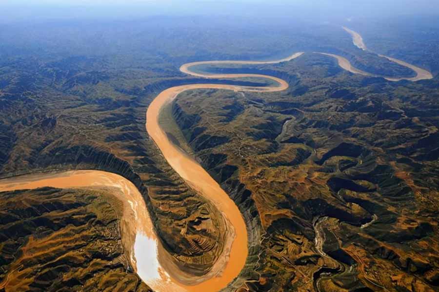
The Yellow River

In the early Stone Age, the soft soil in the Yellow River Basin was obviously easier to cultivate with wood and stone tools than the dense soil in the Yangtze River Basin, so Chinese civilization flourished on both sides of the Yellow River at the earliest time. The Yellow River is situated in the north of China and has the shape of “几(ji)”. It is the second-longest river in China with about 5,464 kilometers. The Yellow River originated at the northern foot of the Bayankala Mountains on the Qinghai-Tibet Plateau and flows eastward. It flows through Qinghai, Sichuan, Gansu, Ningxia, Inner Mongolia, Shaanxi, Shanxi, Henan, and Shandong provinces and autonomous regions from west to east, and finally into the Bohai Sea.
The middle and upper reaches of the Yellow River are dominated by mountains, while the middle and lower reaches are dominated by plains and hills. Because the middle part of the river flows through the Loess Plateau of China, it carries a large amount of sediment, so it is also known as the most sediment-laden river in the world. A large amount of sediment remains in the lower reaches of the Yellow River for a long time, forming an alluvial plain, which is conducive to planting.
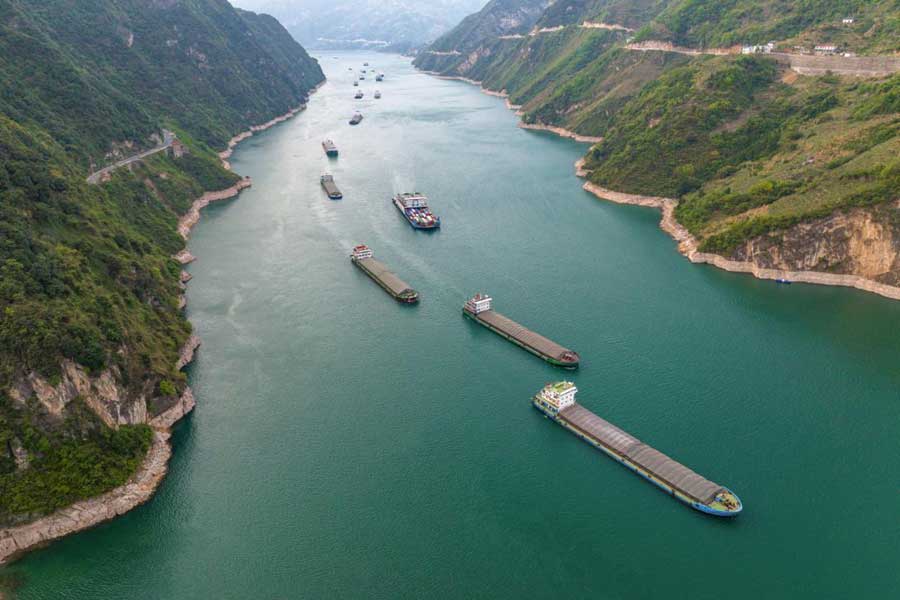
The Yangtze River

The Chinese people’s knowledge of the Yangtze River lagged behind that of the Yellow River for thousands of years. Until 1976, people finally had a relatively accurate knowledge of the headstream of the Yangtze River. The Yangtze River originates from the main peak of the Tanggula Mountains in the Qinghai-Tibet Plateau, the Geladandong Peak. With a total length of 6,387 kilometers, the Yangtze River is more than 900 kilometers longer than the Yellow River. It is the first longest river in Asia and the third in the world, just shorter than the Nile River in Africa and the Amazon River in South America.
The mainstream of the Yangtze River runs through central China from west to east. It flows successively through Qinghai, Sichuan, Tibet, Yunnan, Chongqing, Hubei, Hunan, Jiangxi, Anhui, Jiangsu, and Shanghai, 11provinces, autonomous regions, and municipalities in total, and finally into the East Sea.
The Yangtze River is the largest river in China. It is the main water transport artery across China’s east and west. The volume of freight transportation ranks first in the world’s inland rivers, known as the “Golden Waterway”.The Yangtze River’s main channel rises from Shuifu Port in Yunnan to the estuary of the Yangtze River, with a total length of 2,838 kilometers. Taking advantage of the superiority of the Yangtze River Golden Waterway to reduce logistics costs is an important condition for the development of iron and steel, automobile, and other industries in inland areas.
Other Famous Rivers in China
China is one of the countries with the most rivers in the world. There are many long-standing large rivers. There are more than 1,500 rivers with a basin area of more than 1,000 square kilometers. Except for the Yellow River and Yangtze River, the Pearl River, Heilong River, Songhua River, Liao River, Yarlung Zangbo River, Lancang River, Nujiang River, and Han River are the most famous ones.
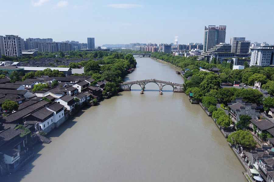
The Beijing-Hangzhou Grand Canal

In addition to natural rivers, there are many artificially excavated canals in China, including the earliest and longest canal in the world, the Beijing-Hangzhou Grand Canal. It is a great project and enjoys equal popularity with the Great Wall in Chinese history. From Hangzhou in the south to Beijing in the north, the Grand Canal runs through Zhejiang, Jiangsu, Shandong, Hebei, Tianjin, and Beijing. It links up the five major river systems of the Qiantang River, Yangtze River, Huai River, Yellow River, and Haihe River with a total length of about 1,800 km.
The Grand Canal has a history of more than 2,000 years since its excavation. It has played an important role in the communication between North and South China. It has promoted economic and cultural development and exchanges between the two regions, especially the development of industry and agriculture along the canal.

